Weekend Weather Alert: Bitter blast, then snow!
A Storm Team 10 Weather Alert is in effect ahead of a bitter blast on Saturday and a significant snowstorm for Sunday and Monday. Let's dive into it!
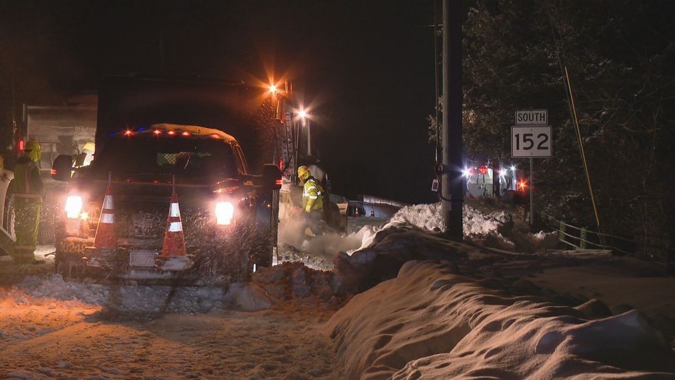
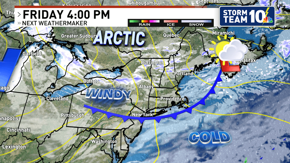
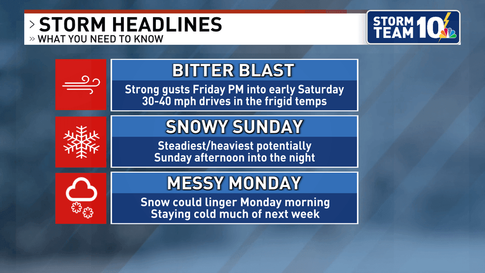
Cold air rushes into Southern New England on Friday afternoon as an arctic cold front blasts through the area, bringing strong wind gusts and tumbling temperatures into early Saturday.
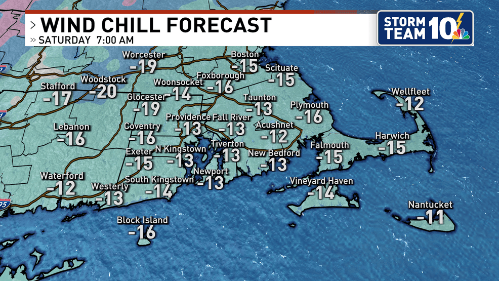
It's quite possible that Saturday's morning wind chill values will be as low as -10 to -20 for some parts of southern New England.
Saturday stays dry but bitterly cold through the day.
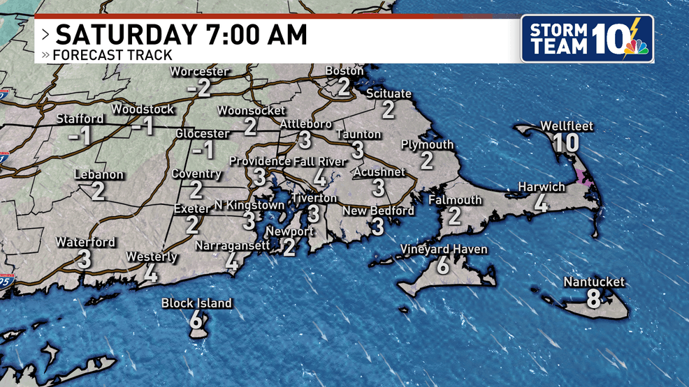
THEN, we shift our attention to Sunday as a widespread, potentially high-impact storm heads our way.
Before this storm arrives here, it will move through much of the southern half of the country, impacting travel significantly due to a combination of ice and snow from Texas through the mid-Atlantic states.
Based on the information we have RIGHT NOW (and with the understanding that this storm is still 3 days away, timing and amounts can and likely will change a bit), this storm has the potential to bring a widespread, heavy snowfall to all areas in southern New England. There continues to be remarkably good agreement across all of the forecast models we look at in terms of the potential of this storm.
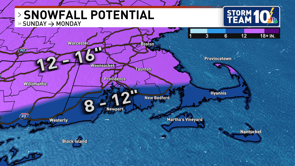
Our map is on the more conservative side due to the threat of snow mixing with sleet early on Monday morning. If we manage to keep the sleet to our south, these totals will be higher. Storm Team 10 should get a better idea over the next day as this storm comes into range for high-resolution models.
What could change?
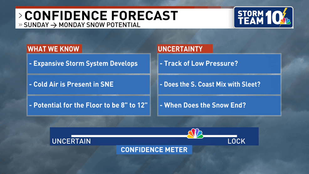
Again, wth a storm system that is well over 72 hours away, there is always the likelihood of a change in the storm track. A shift north or south will mean a change in the amount of snow. It is still too early to go all in on the forecast amounts, but with strong signals pointing to perhaps the biggest snowstorm since the January 2022 blizzard, you can bet that we will keep our attention keenly focused on this over the next several days.
Thanks for reading, Mark.