
Parts of Southern New England wake up to a half-foot of heavy, wet snow

9 AM UPDATE:
The accumulating snow has come to an end this morning after some locations picked up over a half foot from Sunday evening up until now. Many secondary roadways remain snow and slush covered while crews have done a good job keeping main roads and highways clear.
A local jackpot seemingly from this storm was towards the Coventry area where there morning's sole 7"+ report was found. Stay tuned as more reports trickle in this morning, we'll be sure to update our numbers!
5:30 AM UPDATE:
Southern New England is digging out this morning to a widespread 3-6"+ of freshly fallen snow. The heavy, wet snow will be difficult to push around and has also lead to scattered power outages this morning.
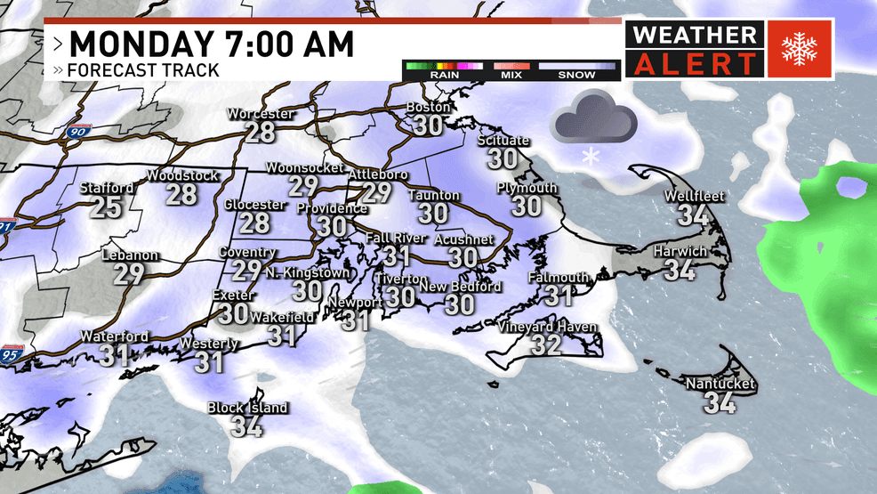
Light snow continues to fall this morning, expected to taper between 8-10 AM for most areas. Slick travel continues to be observed this morning on secondary roadways, while primary roads remain in better shape given the marginal temperatures.

PREVIOUS STORY:
Roads are slippery across Southern New England as a plowable snow has fallen across the region.
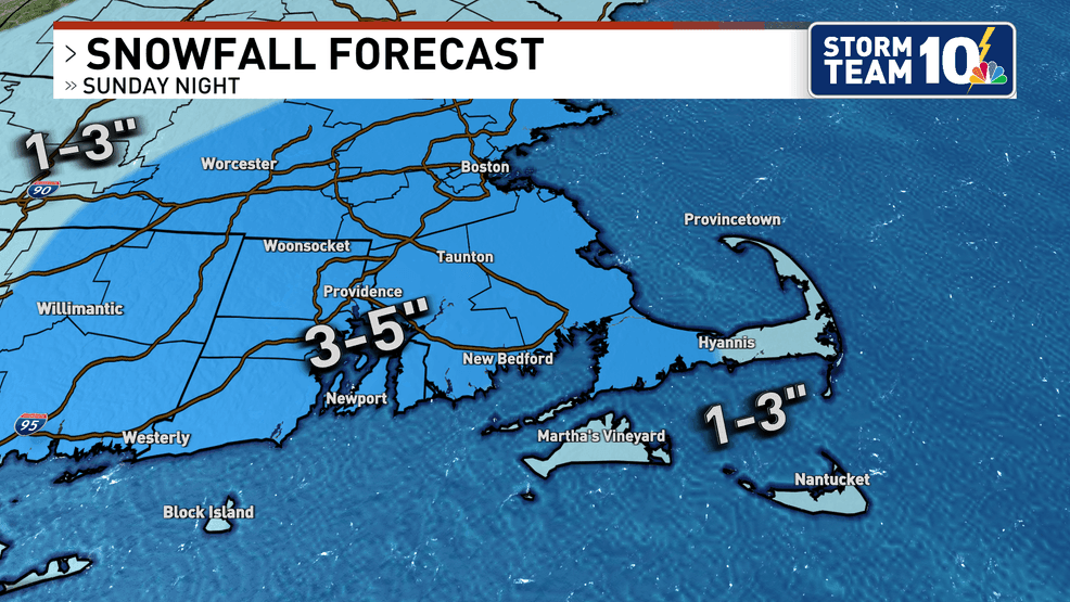
The worst of the storm is wrapped up by midnight, with storm total snowfall accumulation of 3 to 6 inches across the region. However, light snow flurries continue into Monday morning's commute.
Our snowfall forecast remains on track. A widespread 3-6 inches of snow is expected across most of Rhode Island and southeastern Massachusetts, except for the outer Cape and Islands where milder temperatures will prevent much accumulation.
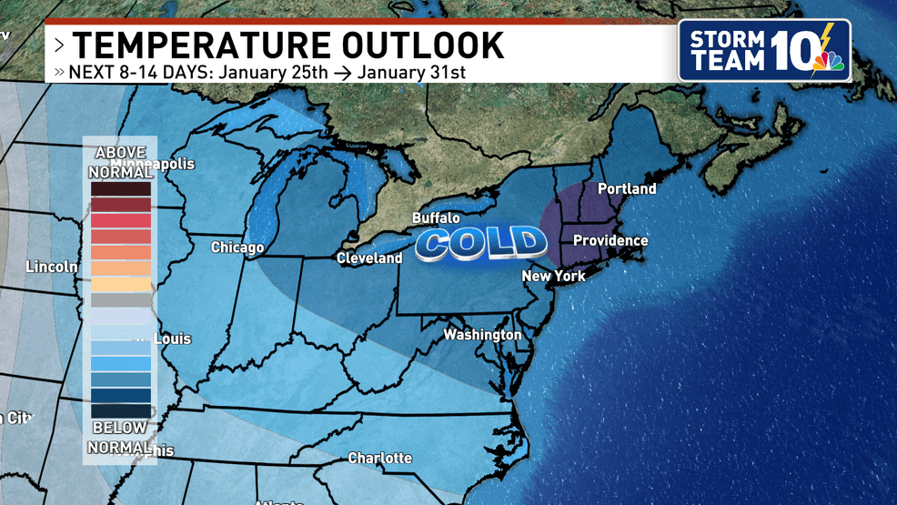
Make sure you take care of removing this heavy, wet snowfall, as there aren't really any opportunities for it to melt going forward through the 10-day forecast. Southern New England gets a tease of what is to come on Tuesday when highs are only in the 20s. Next week, a few days may not even hit 20 degrees during the afternoon...
Thanks for reading! Stay safe and go Pats!