Weather Alerts: Frigid temps and a winter storm on the way!
A StormTeam10 Weather Alert is in place through the weekend as a series of weather events will impact ALL of Southern New England. Not much has changed with the forecast this morning, with bitter cold slated for tonight into Saturday, followed by a winter storm Sunday into Monday.
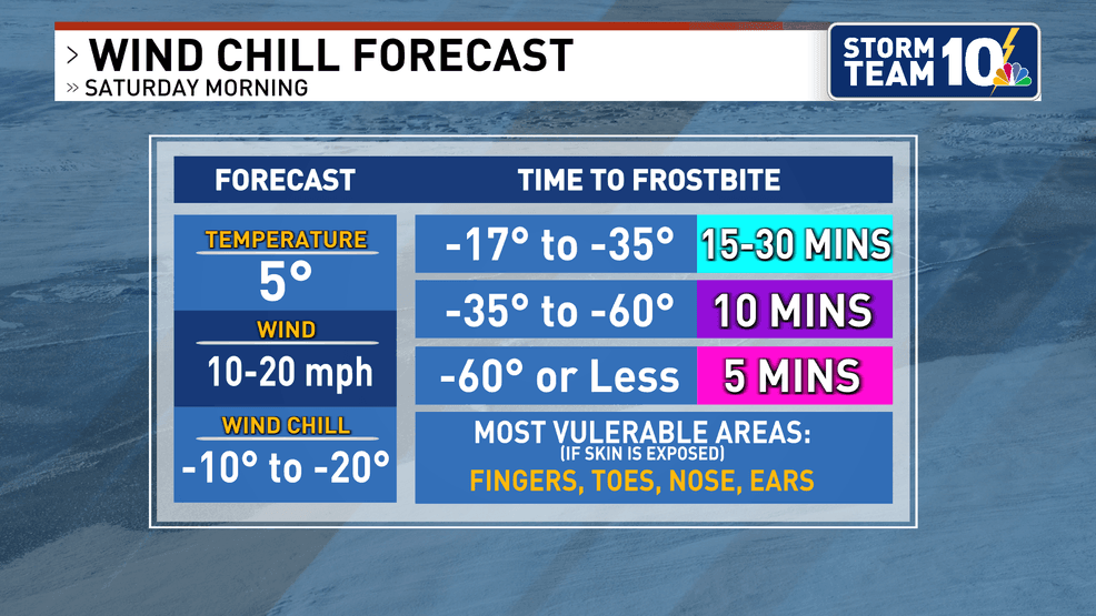
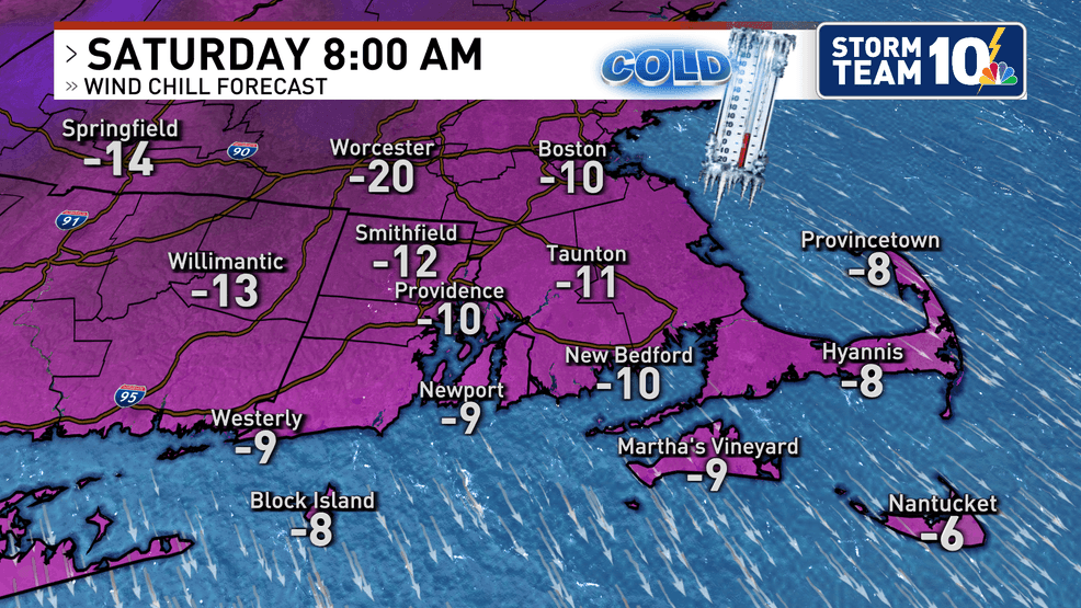
First up is a bitter blast Friday night into Saturday with overnight low temperatures dropping near zero by early Saturday morning.
Wind gusts with this front may reach over 35 mph at times, especially across the higher elevations. That stiff wind will help make Saturday morning feel unbearably cold.
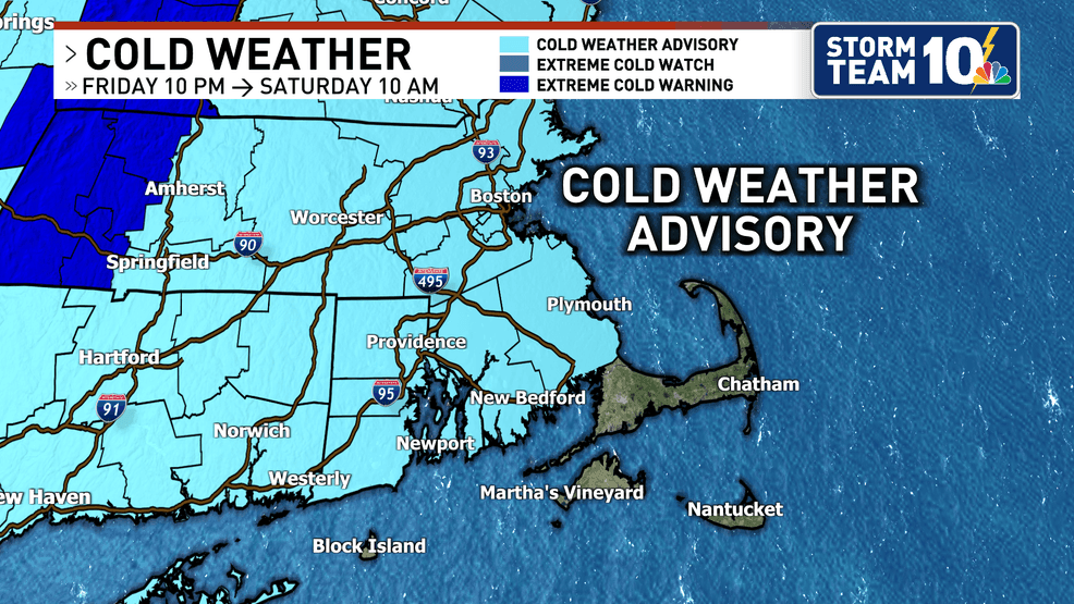
The wind chill will drop to as low as -10 to -20 Saturday morning. A Cold Weather Advisory is in effect for most of us from 10PM tonight until 10AM tomorrow.
After this frigid start, Saturday stays dry but still VERY cold through the afternoon.
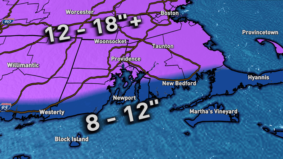
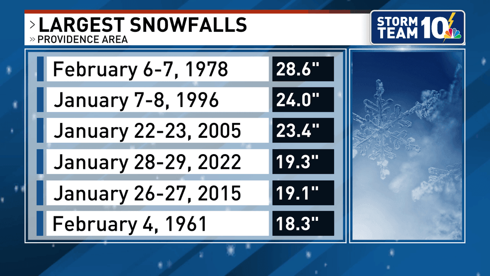
Sunday brings the potential for our biggest snowfall in 4 years, since the January 2022 blizzard!
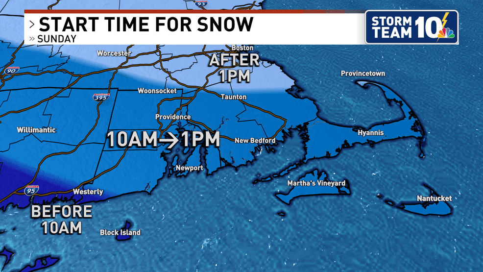
Snow start time looks to be roughly around midday/early afternoon, with the intensity of the snow increasing by evening.
Travel conditions will worsen Sunday afternoon t into early Monday as the storm makes its closest approach. Right now, I still have SOME concern about some sleet POSSIBLY mixing in for areas along our southern coastline.
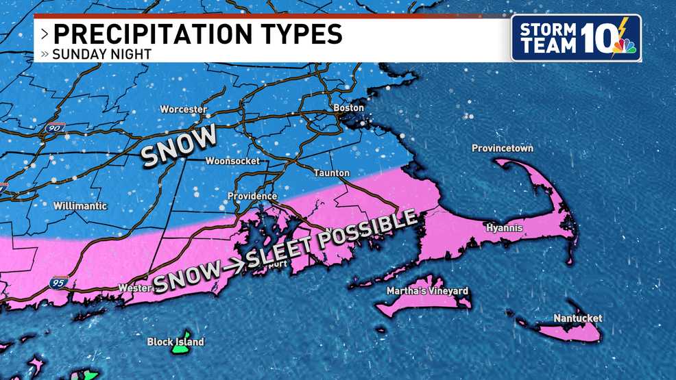
IF no sleet mixes in, this will be a lighter, fluffier snow compared to last weekend's storm.
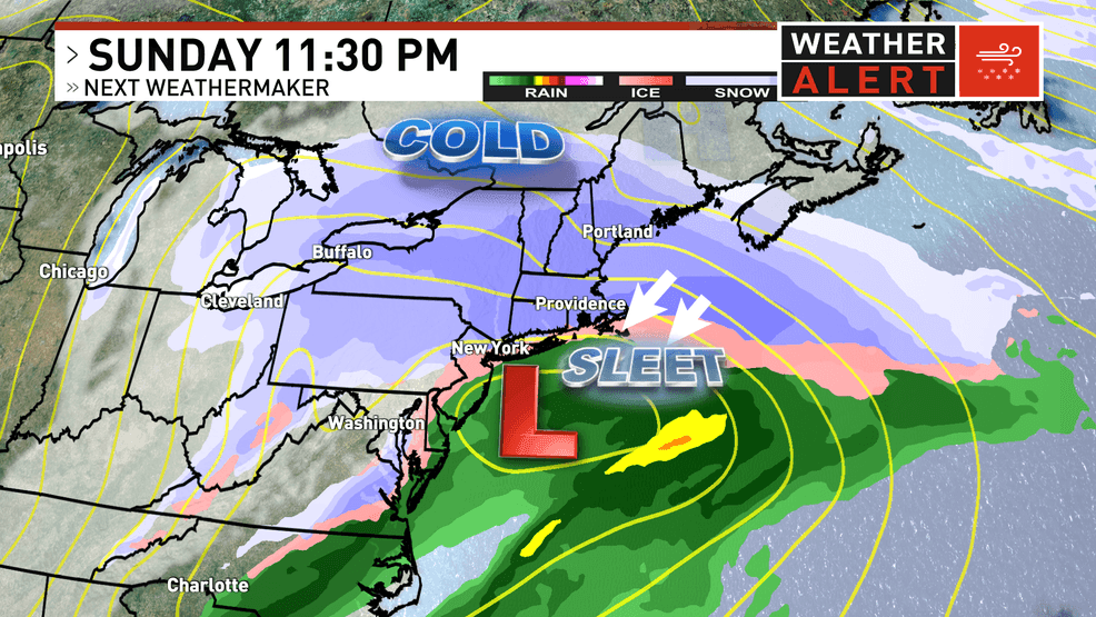
Any sleet would limit accumulation potential in these areas, but again, this is not a certainty, just a possibility at this point. We will know more through the day Friday on this scenario, but here's a look at how it may play out.
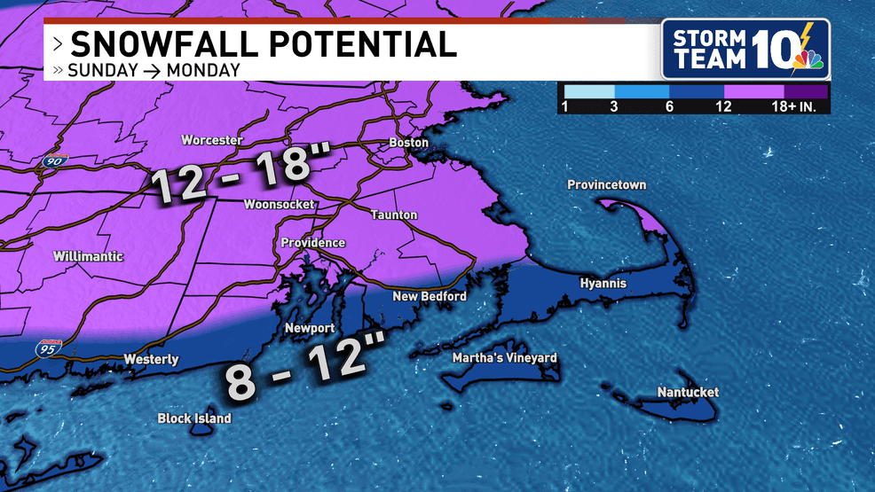
Areas that remain all snow could see a foot to a foot and a half by Monday morning, with the possibility of more snow wrapping back in at times Monday as the storm pulls east of Cape Cod.
So these snow totals could certainly adjust up (or down) as we gain more confidence in the track of the storm.
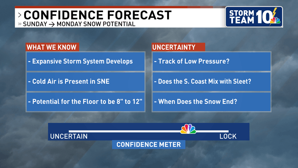
New information from our higher resolution forecast guidance will become more available on Friday afternoon and night, and this will help clarify more of our thinking.
Still plenty of time to prepare, so don't wait! Those frigid temperatures Saturday won't be any fun, and if you can run your errand on Friday morning or early afternoon, you will be glad you did!
Stay tuned for the latest on this forecast, and thanks for reading!