Skip to main content
Mobile Menu Icon
Thumbnails
View Thumbnails
More Galleries
More Galleries
1/12
Close
Close
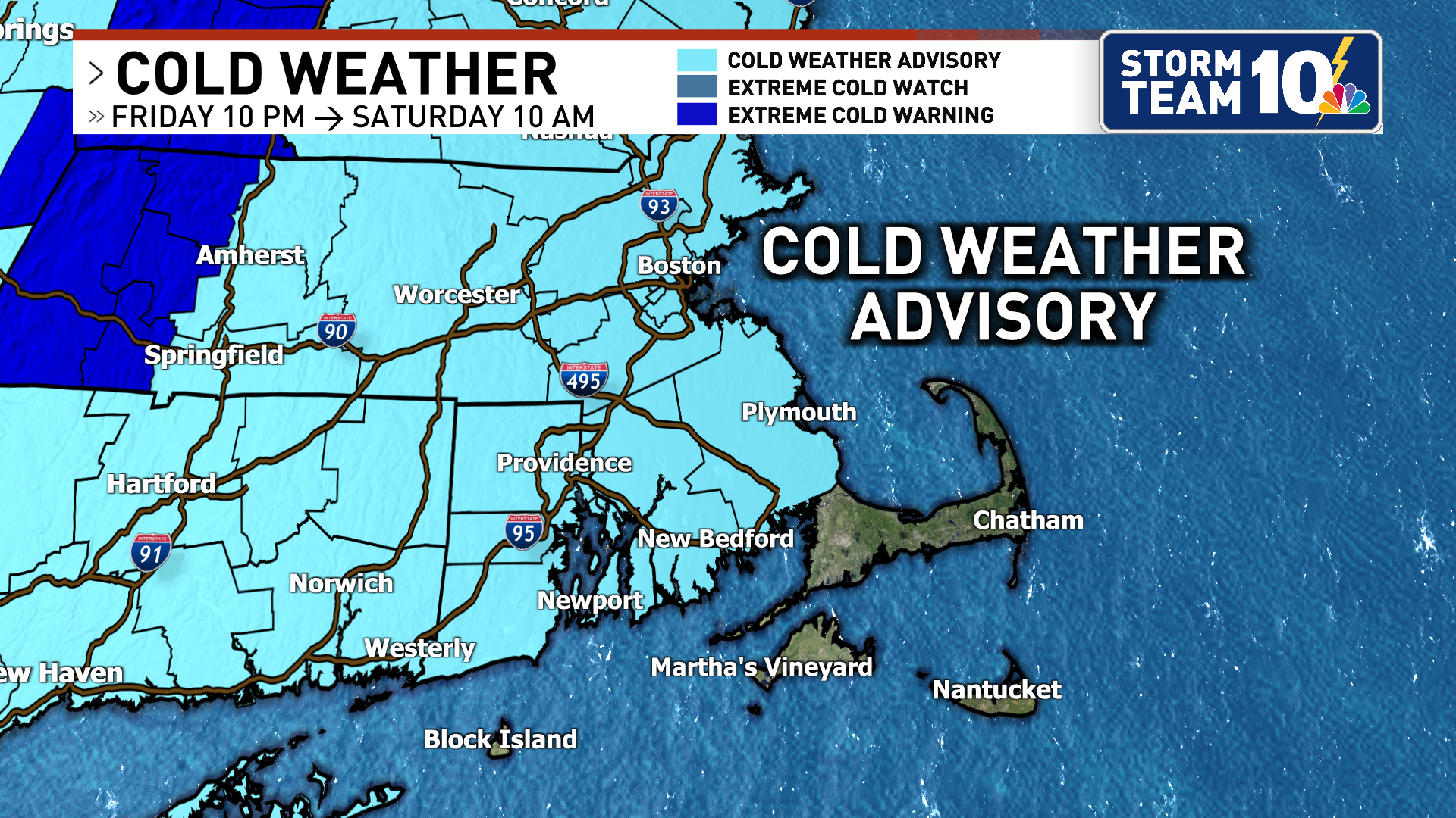
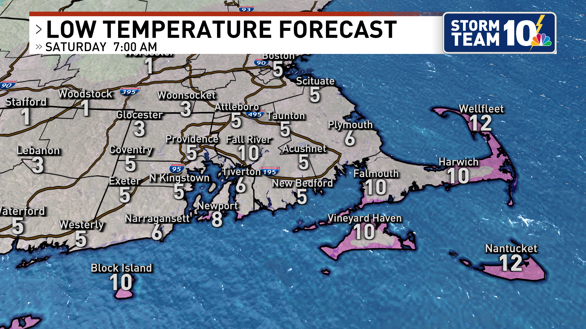
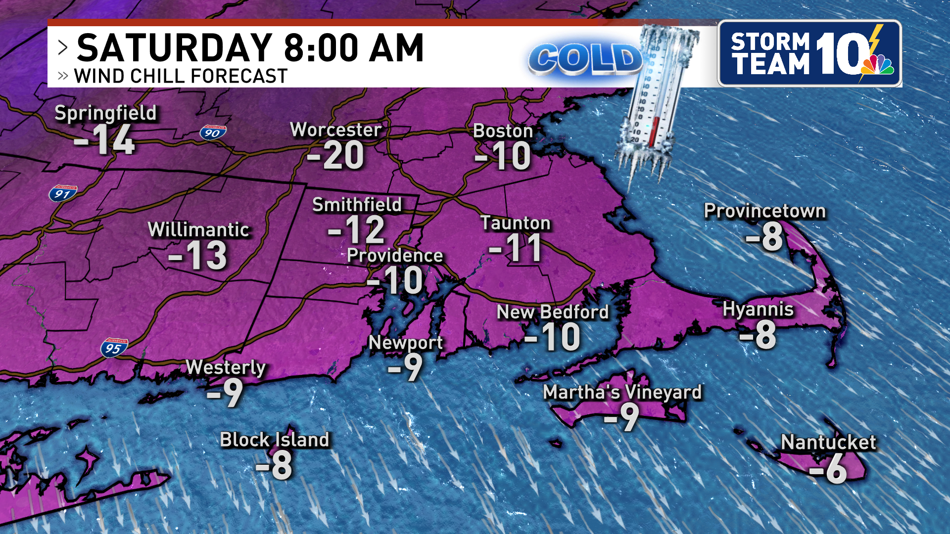
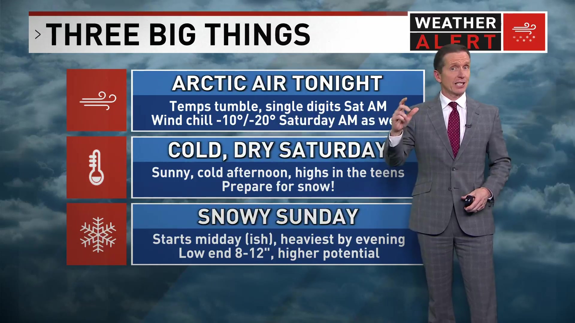
Weather Alerts: Frigid temps and a winter storm on the way!
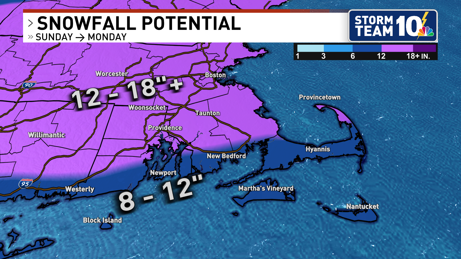
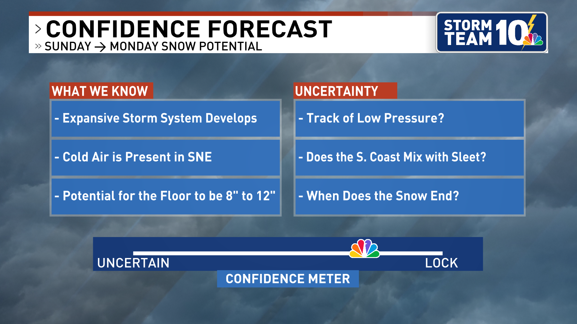
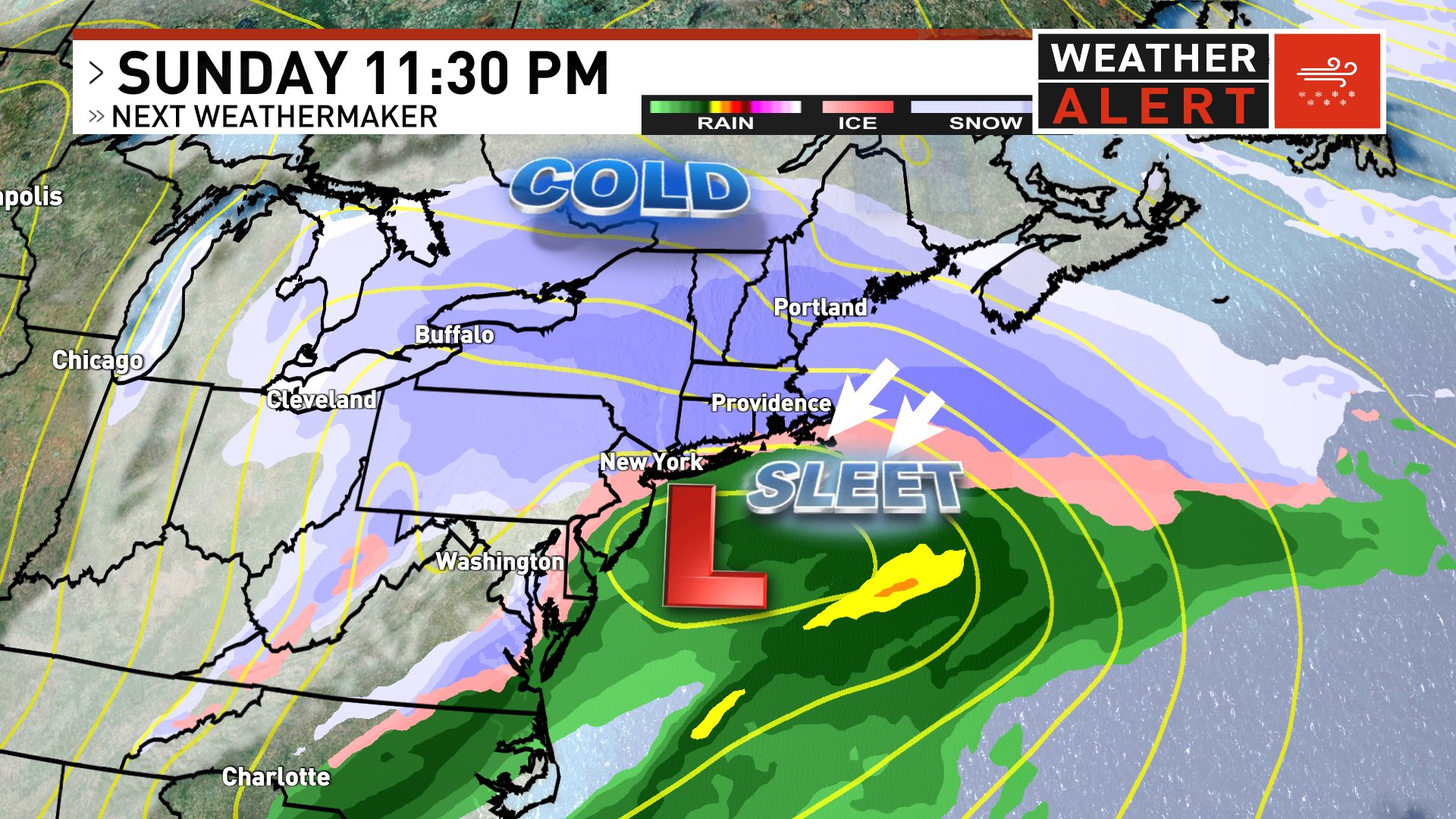
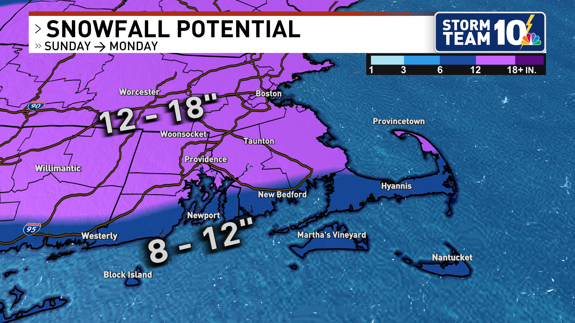
Snow potential as we see it right now{p}{/p}
Read article
Read The Article
SHARE
Facebook Share Icon
X Share Icon
Send via Email Share Icon