Sunday's Snowstorm: What you need to know

The long-awaited arrival of a significant snowstorm is almost upon Southern New England, with the first flakes expected within 24 hours. With such a long lead time, there's been a lot to digest, so let's try to break it down.
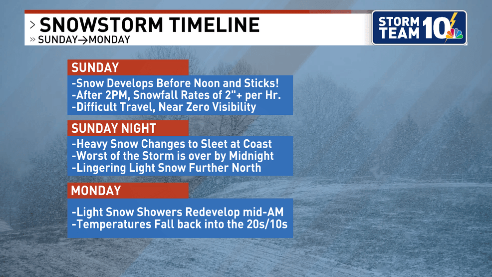
TIMING:
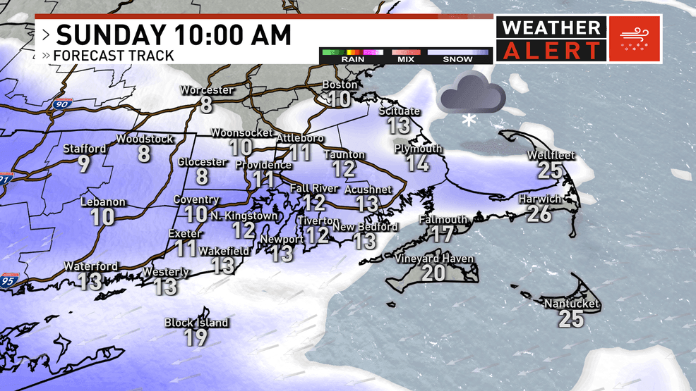
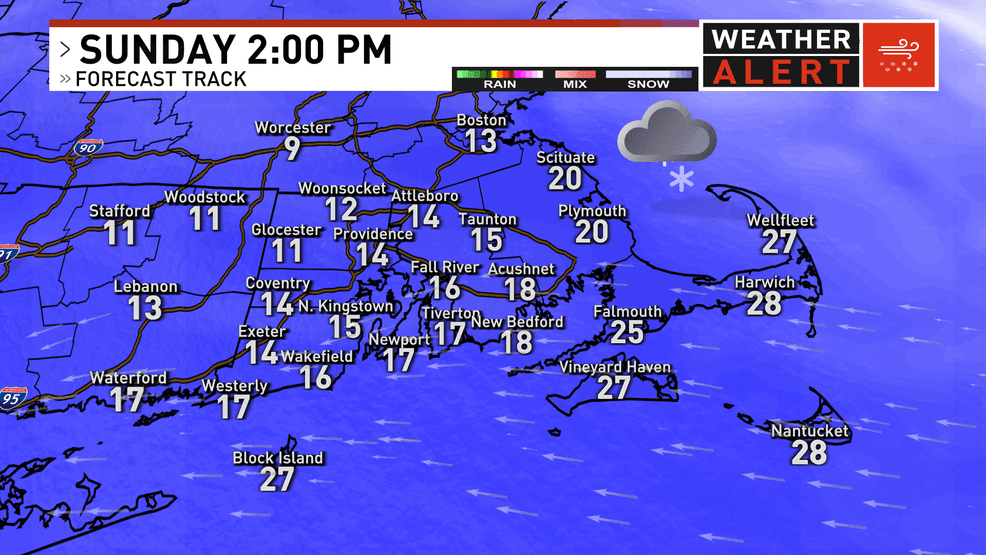
Widespread snow develops on Sunday morning between 9 AM and 12 PM, moving from southwest to northeast. At this point, temperatures are still in the upper single digits and low teens across Southern New England, so snow can stick right away. Even on the heavily treated highways, temperatures are too cold for road salt to be effective.
Snowfall rates gradually ramp up after onset, but the window for the worst conditions opens up around 2 PM. This is when snowfall rates may approach 2-3 inches per hour. These intense rates could easily persist into Sunday evening.
What brings this heavy snow to a halt is a sleet line. Starting at the south coast, snow may flip to sleet as early as 7 PM. However, models vary on the timing of the sleet, with some showing it arriving as late as midnight. Regardless of the timing, once this changeover occurs, snowfall will be capped at whatever is on the ground.
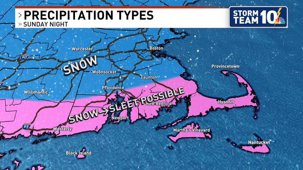
Snow could flip to sleet as far north as Providence, Coventry, Barrington, Swansea, and up through Taunton. Communities further north have the best shot at staying all snow.
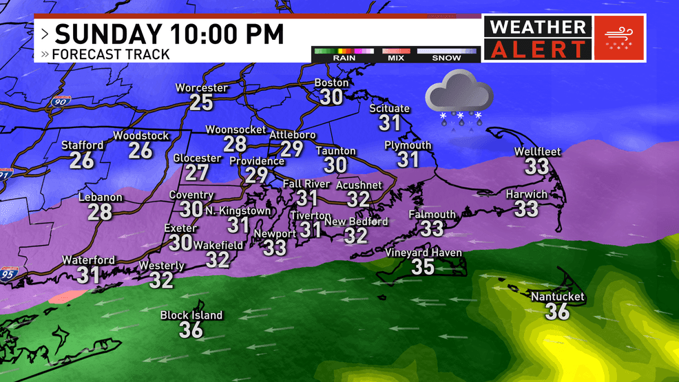
The worst of this storm is ends around midnight, but scattered pockets of sleet and snow linger into Monday morning.
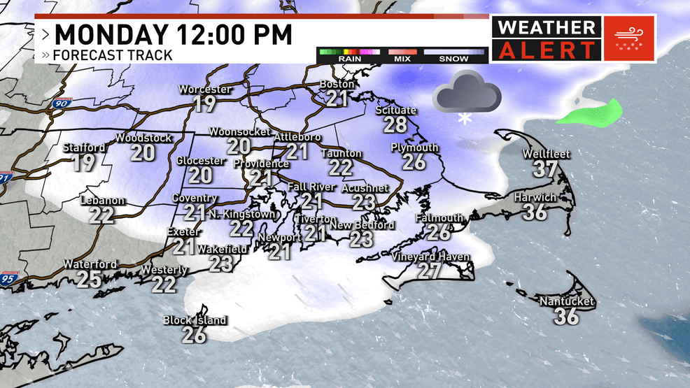
As the area of low pressure pulls away, light to moderate snow redevelops on Monday morning. Depending on how intense this snow is, some further accumulation is possible. Areas north and east of Providence will have the best opportunity for a few inches before snow tapers in the late afternoon.
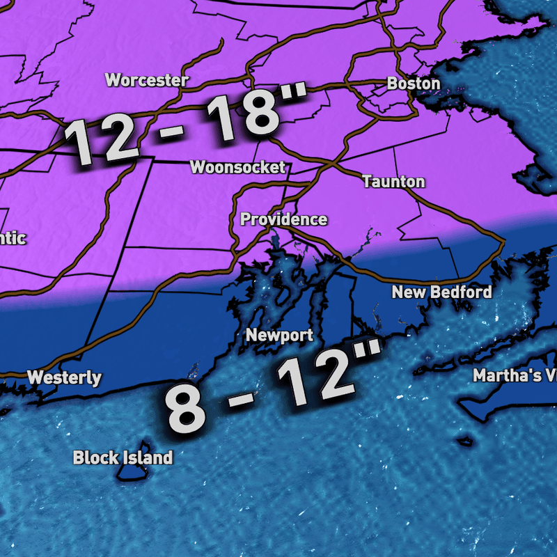
SNOWFALL:
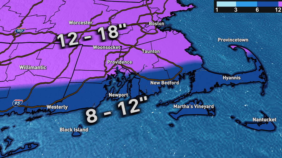
Our snowfall forecast has remained fairly consistent. Totals at the coastline are 8-12" as sleet develops and prevents anything more from stacking up. Further inland/north, especially where it does not sleet, snow totals wind up being 12-18". Most of this snow is on the ground by about 7-8 PM. There is the opportunity for everyone to add a bit to their totals on Monday, with maybe another inch or two possible because of wrap-around snow showers.
IMPACTS
Thankfully, the worst of this storm is on Sunday, so the impacts are slightly reduced. That being said, travel will be difficult on Sunday afternoon/evening. Heavy snowfall rates and blowing snow will produce near-zero visibility, and crews will have a tough time keeping up.
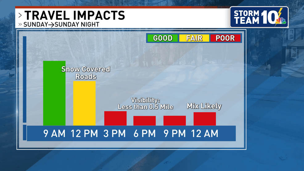
It is important to note that if you plan on watching the Patriots' game from somewhere other than your couch, the drive home is going to be a tough one. Roadways might look manageable pregame, but there could be 8-12" on the road by the end of the game. Road conditions should start to improve by the time many are waking up on Monday morning, but the light snow showers on the backside could lead to some minor issues.
Checkout the latest on School Closings!
Thanks for reading! Stay with Storm Team 10 for the most up-to-date forecast.