Tricky weekend forecast with snow potential on Sunday
Storm Team 10 is tracking the chance for light snow on Sunday across southeastern New England.
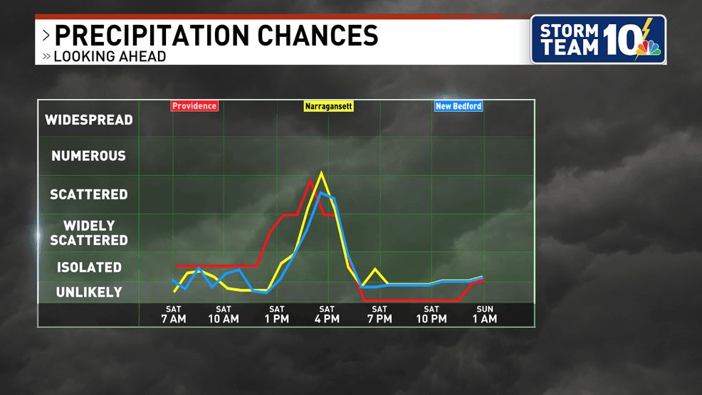
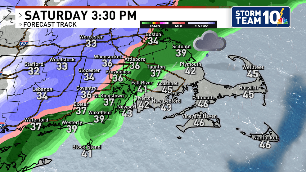
Saturday begins dry with temperatures in the upper 20s/low 30s, but an onshore wind quickly rises temperatures well above freezing for coastal areas through the afternoon. While a passing morning snow or rain shower can't be ruled out, precipitation is expected to be more widespread for Saturday afternoon.
With temperatures in the low to mid 30s north and west of Providence, there may be some flakes flying (especially close to/after sunset). Accumulations given the marginal temperatures should not amount to more than a coating to 1" for much of the region, with the best chance for 2-3" coming for the higher elevations of central and western Massachusetts.
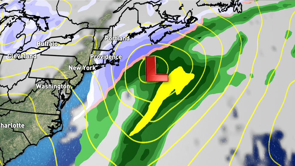
Sunday afternoon and night is where more question marks lie in the forecast as the track of a coastal storm still remains up in the air. Models have been going back and forth over the past few days, and not a ton has come in line this morning. There are countless other models, indices, and forecast methods that go into our thinking; so it's not just the Euro vs. GFS that tells the whole story.
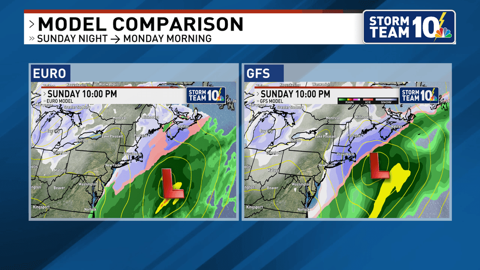
With heavy precipitation expected to be just offshore, any track shift further east or west will have a dramatic shift on impacts and amounts. Finding the middle ground amongst modeling this morning, those east of the Fall River/Taunton areas will have the best chance for steady accumulating snow Sunday night. Timing will likely have to be adjusted, but current indications have snow overspreading southeastern New England between 3-6PM.
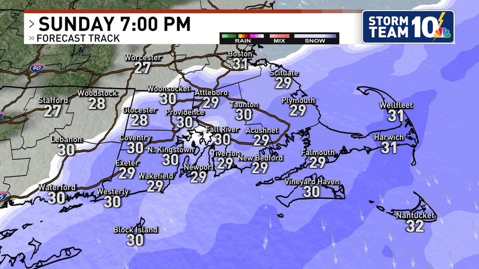
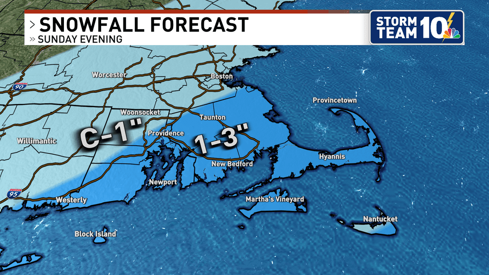
1 to 3 inches is more likely southeast of I-95, with less than one inch for areas northwest of I-95. The best chance for a plowable snow is expected on the Cape & Islands. Snow is expected to end while most are asleep early Monday morning even with a more westerly track.
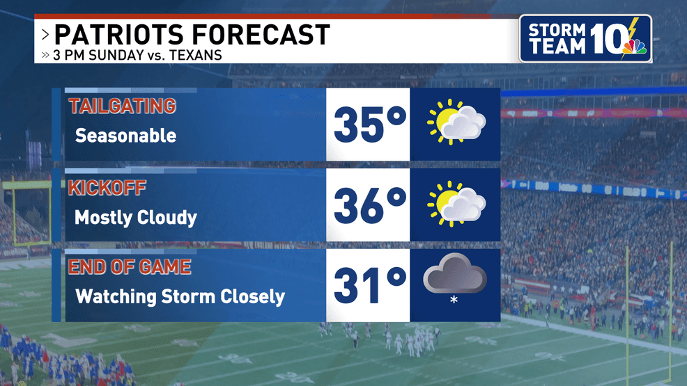
While forecast confidence for Saturday remains fairly high, Sunday night is a different story. This forecast uncertainty also has potential implications for the Patriots divisional playoff game against the Texans Sunday afternoon. Tailgaters and game attendees should expect seasonable temperatures in the mid 30s for the parking lots and start of the game in Foxboro. Currently the forecast is for light snow and flurries to arrive towards the end of the game, picking up after dinnertime for any post game travels. Wind should not be big factor for the game as it's expected to remain at or below 10 MPH.
We cannot emphasize enough that there will likely be adjustments to this forecast as short range modeling comes online and the forecast reaches a higher confidence level. Hopefully this puts some better insight into a tricky forecast for the long weekend, and be sure to stay tuned as Storm Team 10 works extra hard to get you the latest information and updates.
Go Patriots and have a great weekend!

