Ice storm warning issued for Hill Country; San Antonio plunges into dangerous cold
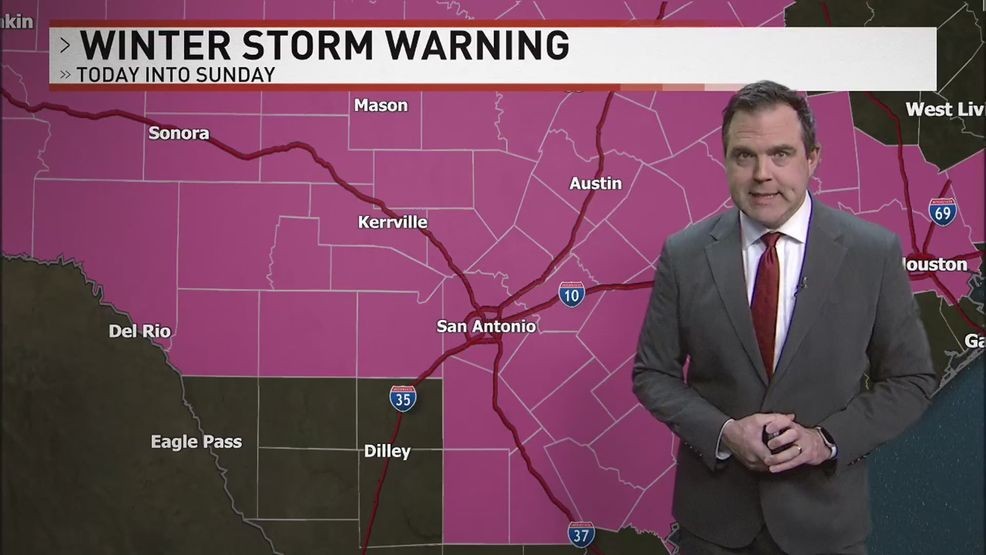
SAN ANTONIO (KABB) — An Ice Storm Warning has been issued for the Hill Country and the I-35 corridor from Williamson County to Comal County
Temperatures and widespread precipitation tonight could lead to significant ice accumulations, making travel nearly impossible overnight and increasing the risk of downed tree limbs.
CLICK HERE to track the showers, sleet and freezing rain with our interactive radar...
ICE STORM WARNING: Until noon on Sunday. Ice accumulations of 1/4 inch with isolated totals of 1/2 inch are possible.
WINTER STORM WARNING from 3PM Saturday through 12PM Sunday. Ice accumulations likely, .10" to .25"+
EXTREME COLD WARNING in effect from Saturday evening through Monday morning for all of South Central Texas. Expect dangerously cold wind chills from -4 to 15 in our area
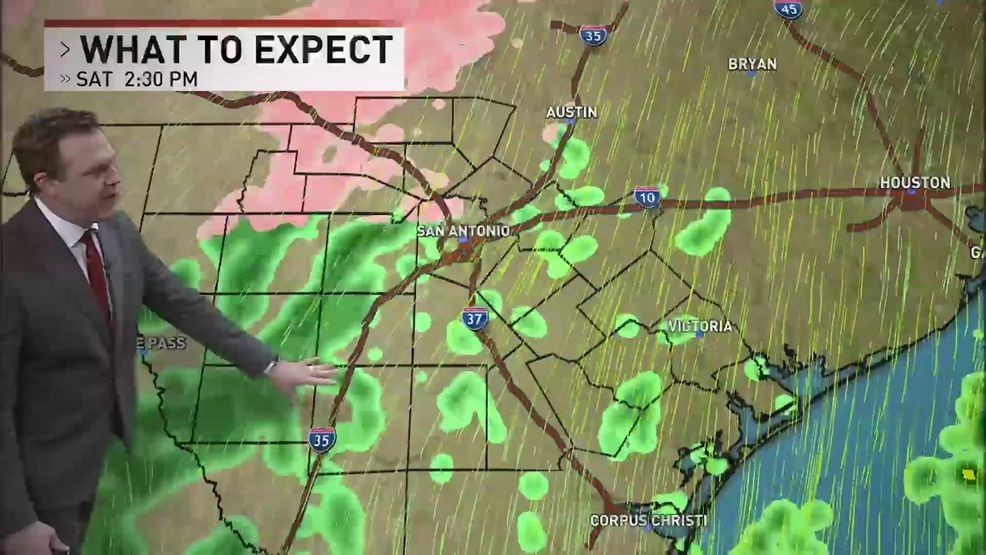
Expect to be near or below freezing in Bexar County as soon as 3 pm today. We’ll be monitoring northern parts of the county for reports of light ice glazing.
We will see very light and spotty activity much of the afternoon. In some cases, it's cold and windy but roads are dry. The Hill Country will see more in the way of slick spots through the morning into the afternoon with occasional patchy light freezing rain or even light sleet later in the afternoon.
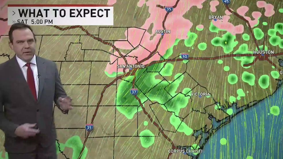
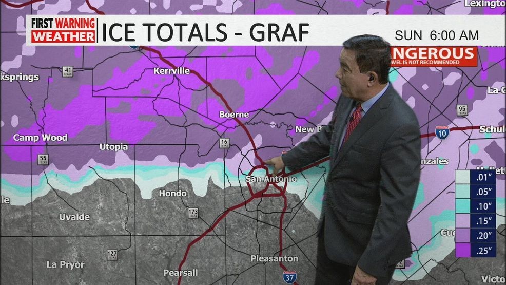
The second wave of moisture arrives from the west after 7 pm and moves through during the overnight hours into Sunday. This is the best chance for widespread slick travel in our region and where we can see ice accumulation between .05" - .25" or more in Bexar County. Some spots, especially in northern Bexar County, could push .25" - but if we see mainly sleet, that would cut into the ice buildup on trees, etc.
The Hill Country will see a little more ice - in the .10" - .30"+ range with a higher risk of ice damage or power outages.
Everything moves out early Sunday before 9 am and the sun will come out.
Weekend Forecast
TODAY:
Patchy Rain, Colder
HIGHS: 33 - 38 (falling temperatures)
WINDS: N 10 - 20mph (higher gusts)
We'll start the day with periods of rain and just wet roads. In the afternoon, the rain should become more spotty and the temperature while cold, stays above freezing. In the Hill Country, there will be risk of freezing rain developing later in the morning to afternoon.
SUNDAY:
30% AM Wintry Mix, PM Sun
HIGHS: 34 - 38
WINDS: N 10 - 20mph
A wintry mix up to about 6AM - 8AM in the area then quickly moves east and out of the area. Sunshine will move in and melt, dry out roads in the area. Could see some black ice by Sunday evening as any areas still wet will refreeze.