Arctic airmass followed by significant snow potential this weekend
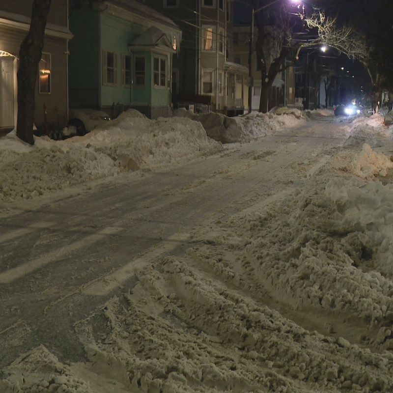
Earlier this morning featured the coldest temperature Providence has seen all winter, and while milder weather is in the forecast for tonight into tomorrow; an extremely bitter and snowy weekend looms ahead. Before the weekend, an appetizer of rain and snow showers will push in for later tonight.
Now back to the weekend...
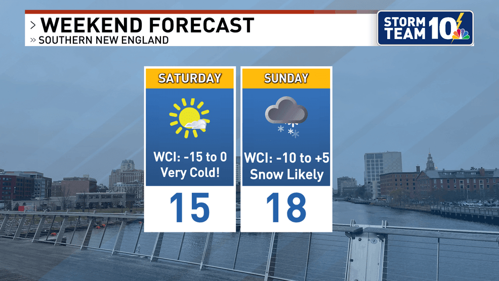
The coldest airmass of 2026 and this winter alike arrives Friday night, with all of Southern New England expected to be in the freezer both Saturday and Sunday. High temperatures both days will only sit in the teens while lows are expected to drop into the single digits and negatives. Feels like temperatures well below zero will likely lead to issuance of cold weather alerts, thanks to the development of some wind as a high and low pressure battle it out.
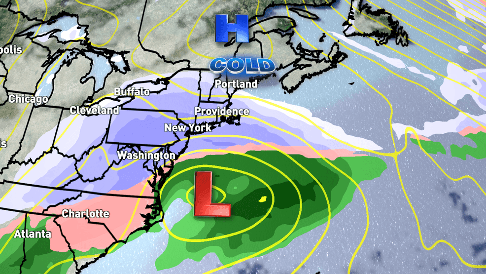
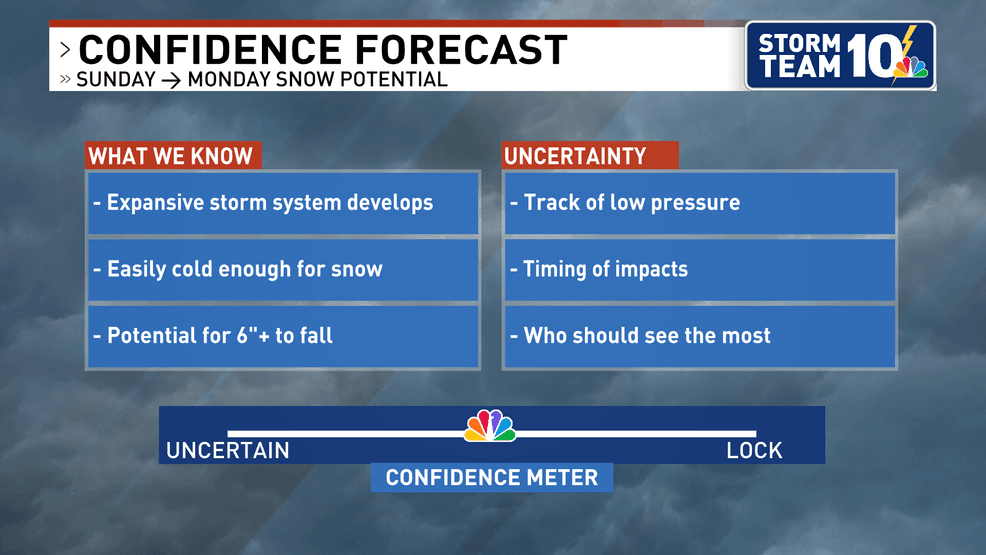
Forecast modeling continues to point towards the development of an impactful winter storm through the weekend, expected to make it's way into Southern New England given the latest track probabilities. While uncertainty remains, the ingredients are present for a potentially significant winter storm.
As the Arctic airmass invades this weekend, it will come along with an expansive area of high pressure featuring ample cold and dry air. As a trough dips across the eastern half of the U.S., low pressure will develop across the Southeast and strengthen into a major winter storm in places that don't normally get much snow. The storm will then slide east, strengthening as it makes a close pass to Southern New England.
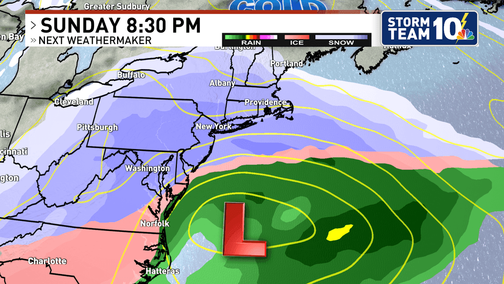
There will likely be at least a plowable snow across much of Southern New England late Sunday into Monday, but the exact snowfall forecast won't be known for a couple more days.
We are all eager to get more details on this anticipated cold and storm-system, so we'll be sure to keep everyone updated as we get closer to the weekend.