Snow game at Gillette? The latest on Sunday's system

All eyes are on Sunday's forecast as a coastal storm brings widespread snow to the region. However, Mother Nature still has a trick up her sleeve, calling an audible that throws a wrinkle into the forecast. Let's break it down so you are not blindsided and left to scramble.
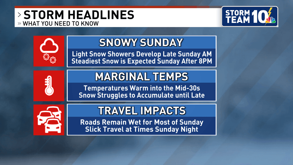
Models have come into better agreement when it comes to snow developing during the late morning hours on Sunday. Initially, this activity is fairly scattered due to lingering dry air in the mid-levels of the atmosphere. It might take until the early afternoon before coverage becomes more widespread.
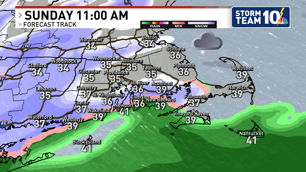
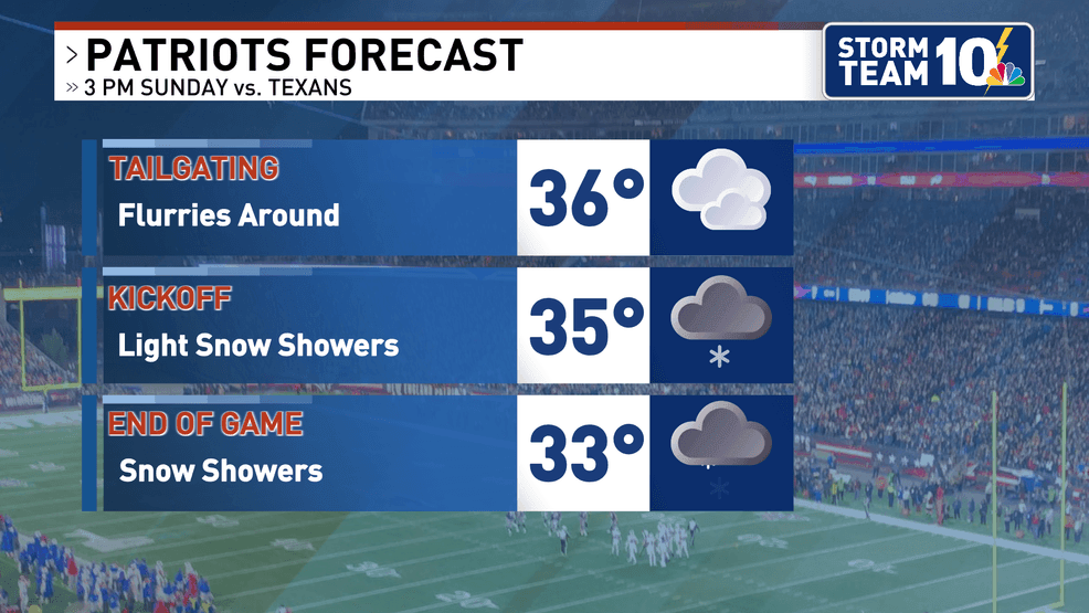
Snowflakes will be flying at kickoff for the Patriots vs. Texans game at Gillette Stadium, yet temperatures remain fairly marginal, limiting any accumulation at first.
These marginal temperatures are the big question that Mother Nature has left us to answer. Even though it could be snowing for 6-8 hours on Sunday during the day, we think the snow will struggle to stick to anything other than the cold surfaces. Travel shouldn't be impacted as roads remain primarily wet until after sunset on Sunday evening.
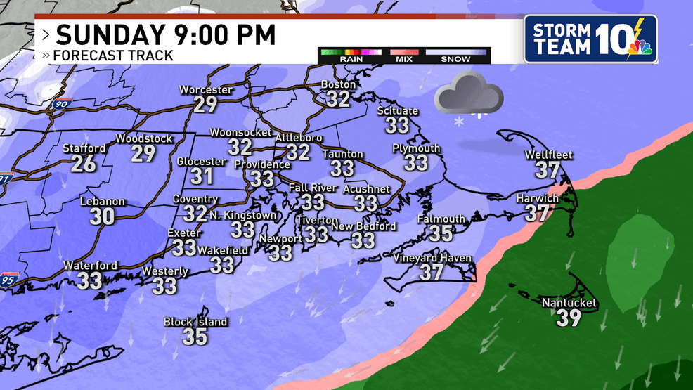
Cold air starts to filter into Rhode Island and southeast Massachusetts slowly on Sunday evening. Once we hit the freezing point, snow should stick rather quickly. Most of the accumulating snow falls from 5 p.m to midnight.
We've slightly increased the forecast to a widespread 3 to 5 inches of snow. Less snow is expected on the outer Cape and Islands due to milder temperatures, which will prevent much snow from sticking.
Most of this snowfall is Sunday night.
For all of the latest on the forecast, stay with Storm Team 10.
Go Patriots!
-JD